
Choosing the right surveying method can significantly impact project timelines, costs, and accuracy.
In modern infrastructure development, two major technologies dominate the field:
- LiDAR (Light Detection and Ranging)
- Traditional Surveying (Total Station & Manual Methods)
But which one is right for your project?
At TerraModus India Pvt. Ltd., we provide both advanced LiDAR scanning and traditional surveying services across Delhi NCR, and the answer depends on your project scale, accuracy requirements, and deliverables.
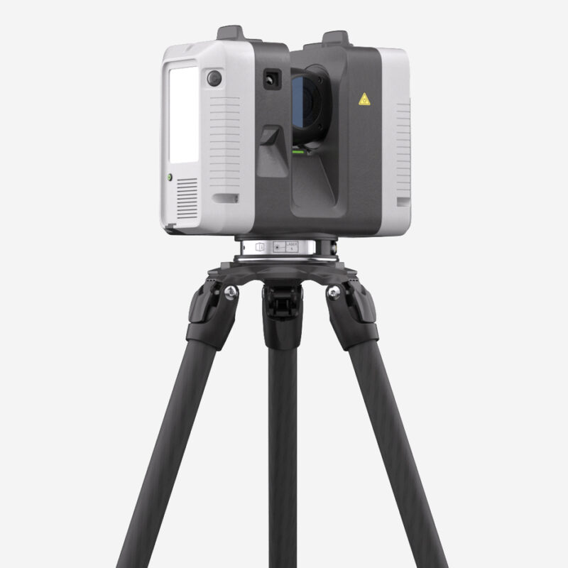
What Is LiDAR Surveying?
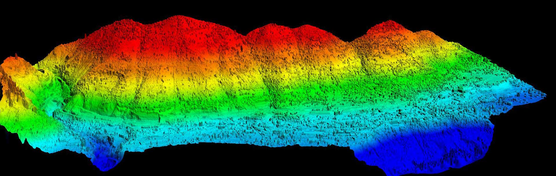
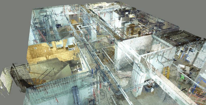
LiDAR (Light Detection and Ranging) uses laser pulses to measure distances and generate high-density 3D point clouds of terrain, buildings, and infrastructure.
It can be deployed via:
- Tripod-mounted laser scanners
- Mobile scanning systems
- Drone-based aerial LiDAR
LiDAR captures millions of points per second, producing highly detailed 3D digital models.
What Is Traditional Surveying?
Traditional surveying typically involves:
- Total Stations
- DGPS / RTK systems
- Manual prism-based measurements
Surveyors measure individual points one by one, creating structured coordinate data for mapping and layout.
Traditional methods are proven, reliable, and widely used in construction.
Key Differences: LiDAR vs Traditional Surveying

1️⃣ Speed of Data Collection
LiDAR:
- Extremely fast
- Captures millions of data points instantly
- Ideal for large sites and complex environments
Traditional Survey:
- Slower
- Measures selected critical points
- Suitable for smaller or controlled areas
2️⃣ Data Density & Detail
LiDAR:
- High-density 3D point cloud
- Captures full surfaces and structures
- Ideal for BIM, digital twins, and complex modeling
Traditional Survey:
- Captures specific measured points
- Best for layout, boundaries, and engineering control
3️⃣ Accuracy
Both methods can achieve high accuracy when executed properly.
- Total Station: Millimeter-level accuracy
- DGPS: Centimeter-level accuracy
- LiDAR: Millimeter to centimeter depending on equipment
For layout and structural alignment, traditional methods often remain essential.
4️⃣ Project Size Suitability
| Project Type | Recommended Method |
|---|---|
| Large Infrastructure | LiDAR + DGPS |
| High-Rise Building Layout | Traditional + DGPS |
| Industrial Plant Mapping | LiDAR |
| Highway Corridor | LiDAR + DGPS |
| Plot Demarcation | Traditional Survey |
When Should You Choose LiDAR?
Choose LiDAR if your project requires:
✔ Detailed 3D modeling
✔ As-built documentation
✔ Complex geometry capture
✔ Large-area topographic mapping
✔ Smart city or digital twin integration
LiDAR is ideal for modern infrastructure projects where data-rich modeling is required.
When Should You Choose Traditional Surveying?
Choose traditional surveying if you need:
✔ Precise construction layout
✔ Boundary demarcation
✔ Legal land surveys
✔ Control network establishment
✔ Foundation marking & grid setup
Traditional surveying remains essential for execution-stage construction.
The Smart Approach: Combine Both
For most large-scale projects in Delhi NCR, the best solution is not choosing one over the other — but integrating both.
LiDAR provides comprehensive spatial data.
Traditional surveying ensures engineering-grade control and accuracy.
Together, they create a complete, reliable spatial foundation.
Why Choose TerraModus India Pvt. Ltd.?
We offer:
✔ Advanced LiDAR scanning
✔ DGPS & RTK surveys
✔ Total station layout services
✔ BIM-ready point cloud modeling
✔ GIS integration
✔ End-to-end infrastructure digitization
Our team evaluates your project and recommends the most efficient and cost-effective surveying strategy.
Conclusion
LiDAR and traditional surveying are not competitors — they are complementary tools.
The right choice depends on:
- Project scale
- Accuracy requirements
- Deliverable type
- Budget
- Timeline
If you’re planning infrastructure, real estate, or industrial development in Delhi NCR, TerraModus India Pvt. Ltd. can help you choose the right surveying solution.