High-Accuracy Manhole & A Large-Scale Stormwater Digitization Project in Vilnius
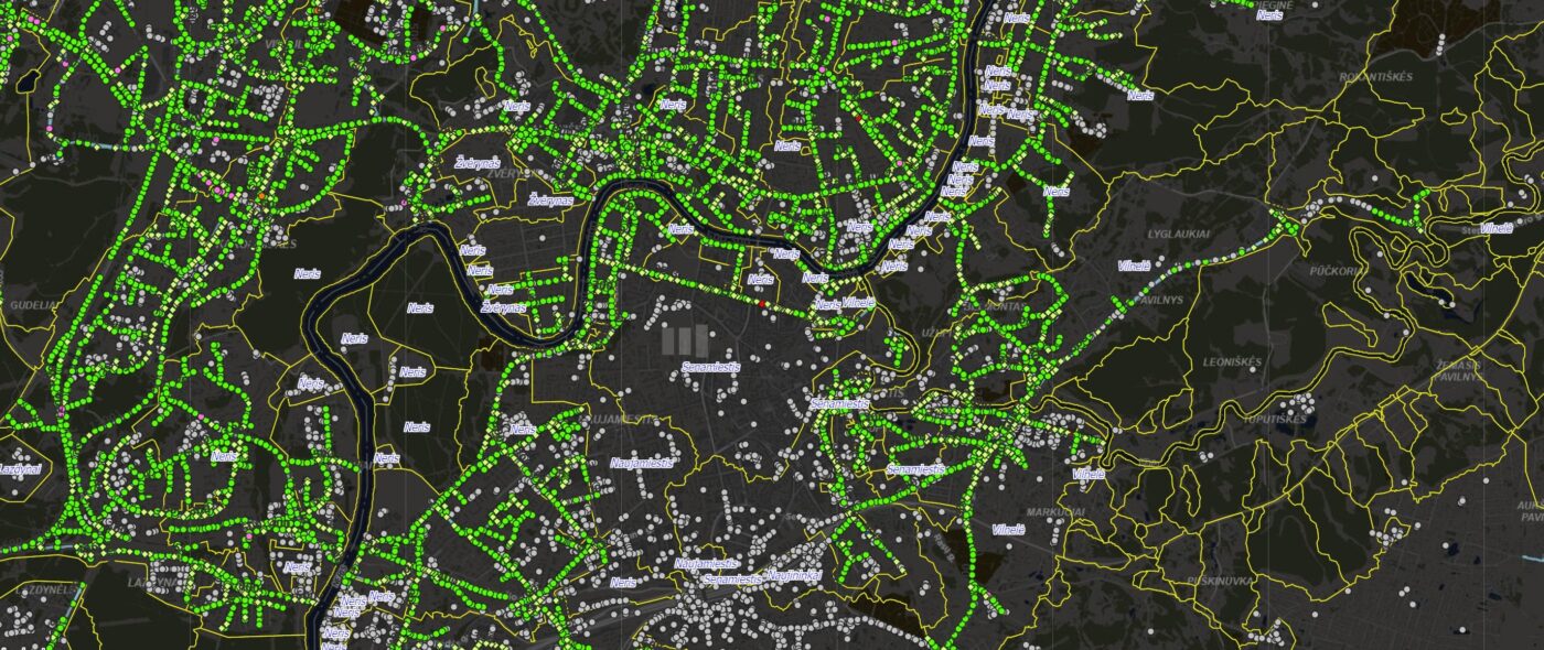
Urban infrastructure is often invisible — but it is critical. Beneath the streets of Vilnius lies the largest stormwater network in Lithuania. Terra Modus was entrusted with digitizing and inventorying one of the most complex underground rainwater systems in the region.
This project required precision, innovation, and operational efficiency at scale.
Project Overview
Client: “Grinda” – Municipal company owned by the Vilnius City Municipality
Objective: Inventory and digitize the underground stormwater network
Scope:
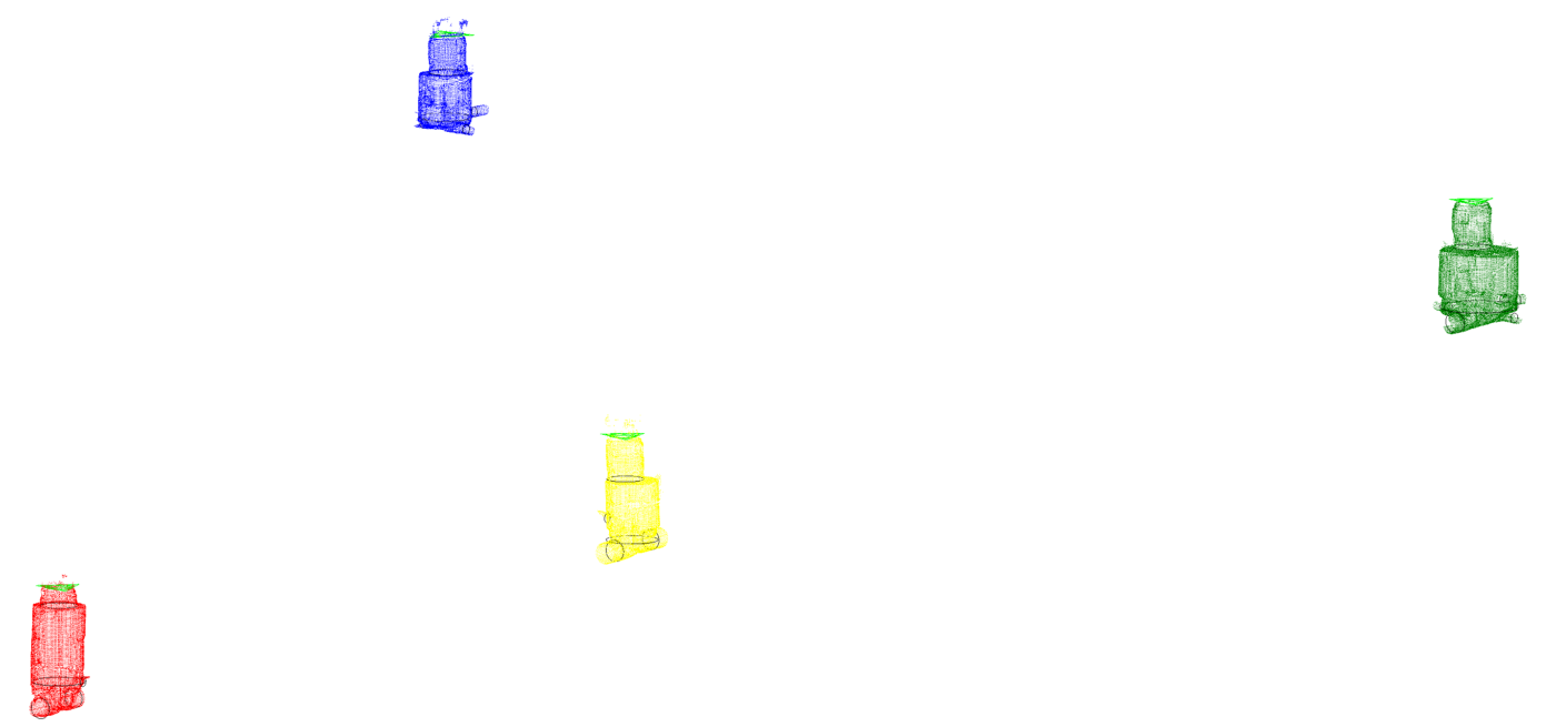
- 12,500 main underground manholes scanned
- 500+ km of network measured
- 6-month project duration
- Average 80 manholes scanned per day
Deliverables:
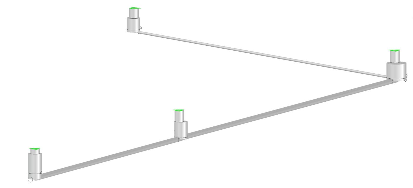
- Complete geo-referenced 3D model of the stormwater system
- GIS database integration
- High-accuracy 3D scan data for long-term asset management
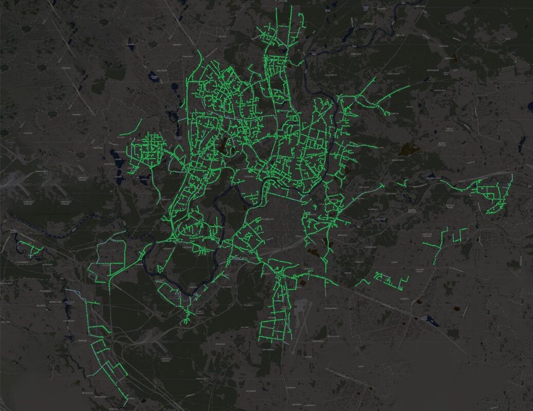
Vilnius’ full stormwater infrastructure includes:
- 1,700+ km of pipes
- 17,500 total manholes
This was not just a scanning project — it was full-scale digital transformation of municipal underground infrastructure.
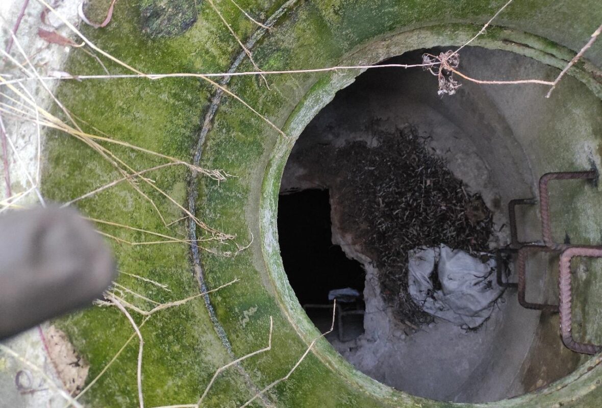
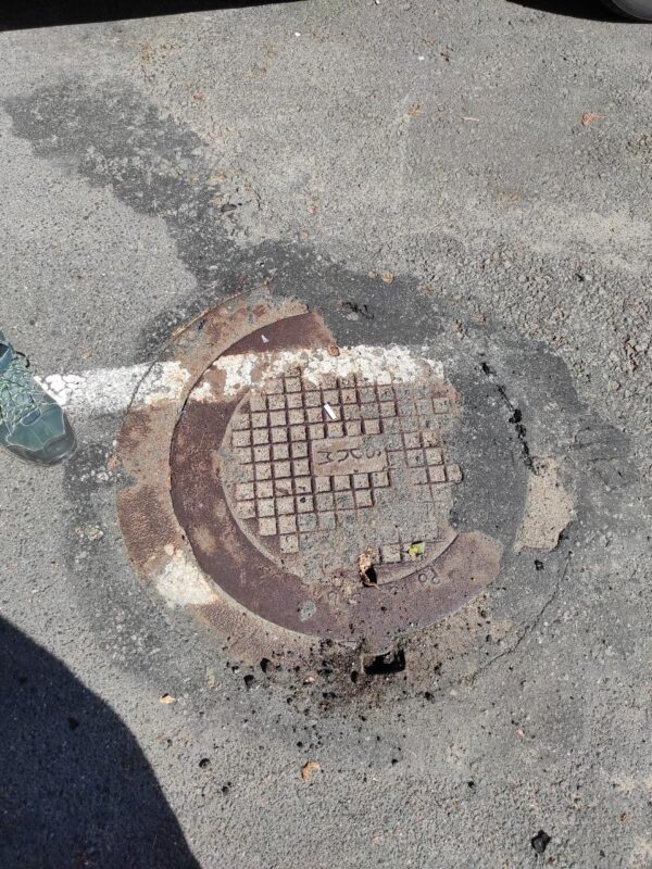
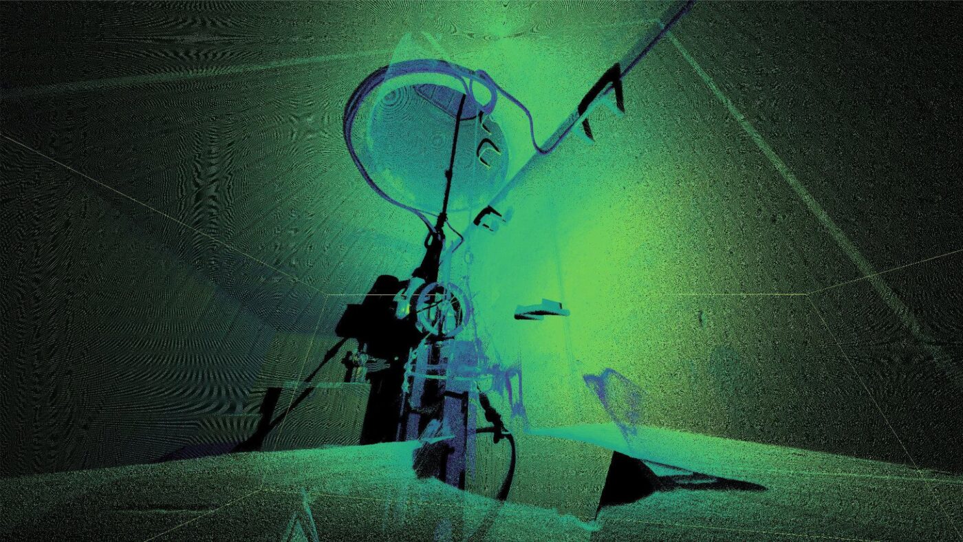
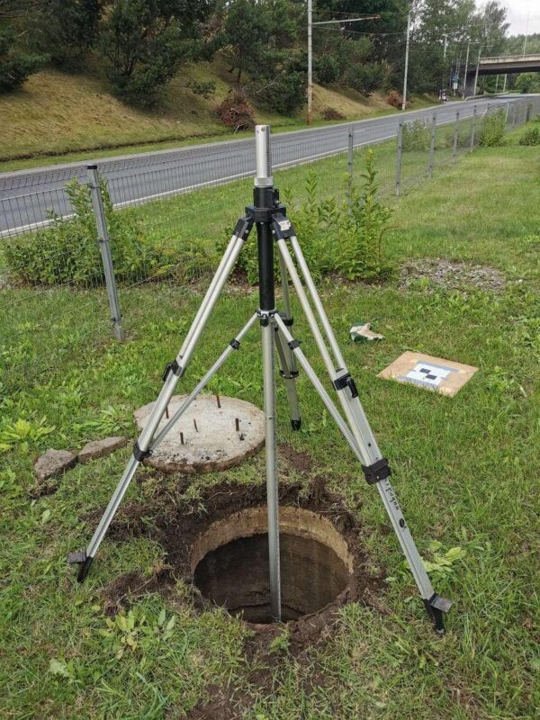
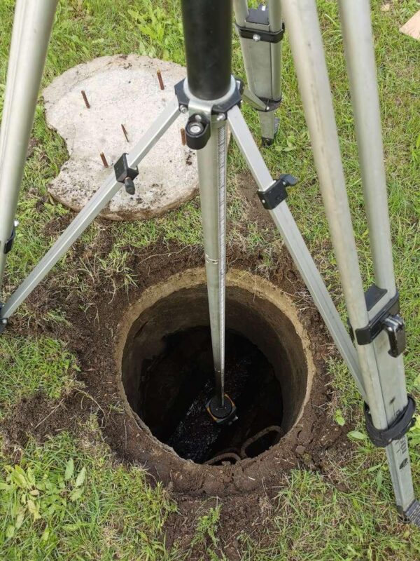
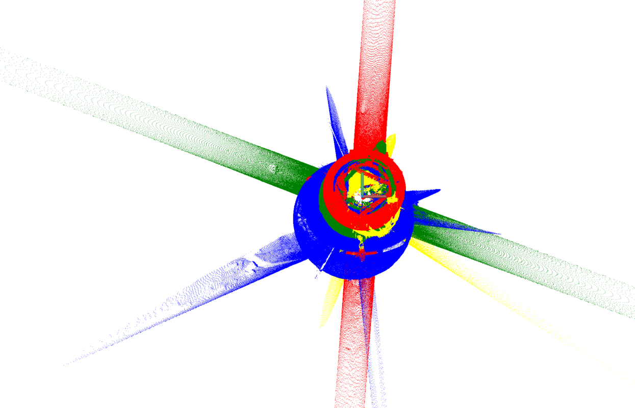
The Core Challenge: 3D Scanning Underground
Scanning underground manholes presents unique technical and operational challenges:
Field Challenges
- Confined spaces
- Limited access
- Traffic safety risks
- Unpredictable weather
- Equipment positioning constraints
Office & Processing Challenges
- Large-scale point cloud data management
- Project-specific accuracy requirements
- Critical network information extraction
- 3D model preparation
- GIS database structuring
Most importantly, traditional georeferencing methods were inefficient for this scale. A new workflow had to be developed.
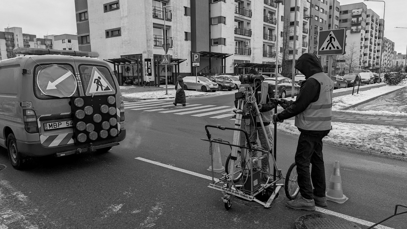
Innovation: A New Georeferencing Method
To achieve high productivity (80 manholes per day), the team developed a new georeferencing approach that allowed:
- Faster scan alignment
- Accurate vertical and horizontal referencing
- Reduced time spent per location
- Consistent quality control
This innovation dramatically improved productivity while maintaining engineering-grade accuracy.
Workflow Optimization & Improvements
The project evolved in stages:
First Stages
- Testing scanning setups
- Evaluating safety workflows
- Identifying bottlenecks
Improvements
- Streamlined field procedures
- Optimized scan positions
- Accelerated data transfer and processing
- Standardized modeling protocols
These improvements ensured consistent production rates and reliable data output.
Results & Impact
By the end of the project, Vilnius municipality received:
✔ A complete digital 3D model of the stormwater system
✔ A structured GIS database
✔ Geo-referenced scan data for future maintenance
✔ A long-term asset management foundation
This project demonstrates how reality capture and 3D scanning can transform municipal infrastructure management — even in complex underground environments.
Why This Matters for Infrastructure Owners
Digitizing underground networks provides:
- Accurate asset inventory
- Faster maintenance planning
- Reduced excavation risk
- Improved emergency response
- Data-driven infrastructure management
For cities with aging infrastructure, 3D digitization is no longer optional — it is strategic.
About Terra Modus
With over 15 years of experience in Reality Capture, Terra Modus has delivered:
- Laser scanning & photogrammetry projects since 2007
- 2D / 3D / BIM modeling from point clouds since 2009
- Large-scale infrastructure digitization across Europe
- Now we are aiming to provide the same expertise to the Indian Market and local Challenges
We specialize in turning complex physical environments into precise digital assets.